Details
Location
Middle East
Well Type
Horizontal
Formation
Limestone
Hole Size
6-1/8 in.
Depth
Lateral length: 4,505 ft (1,373 m)
Reservoir exposure: 4,141 ft (1,262 m)
Reservoir exposure: 4,141 ft (1,262 m)
Products/Services
×
![]()
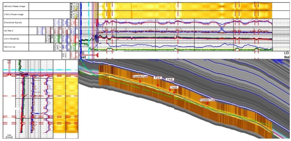
Final interpretation of the lateral section detailing the precise position of the well within the reservoir and adjacent formations.
×
![]()