Details
Location
Middle East
Well Type
Horizontal
Formation
Sand-shale
Hole Size and Angle
6-1/8 in., 91.5°
Total Depth
6,630 ft (2,020 m)
Logging Interval
5,298 to 6,630 ft (1,614 to 2,020 m)
Footage Drilled
1,332 ft (405 m)
Products/Services
×
![]()
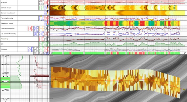
Geosteering model with the GuideWave CLEAR multilayer mapping-while-drilling service with log information obtained: ROP, gamma ray, resistivities, density-porosity, and imagen density.
×
![]()