Details
Location
Asia
Well Type
Exploration
Hole Size and Angle
8 1/2 in., 36.7°
Products/Services
×
![]()
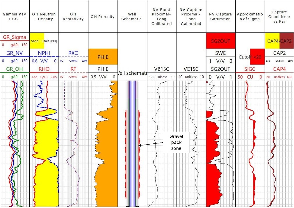
Gas saturation from capture ratio curve in the gravel pack zone is significantly lower compared to effective water saturation from open hole from top to bottom lobe, suggesting water influx effect and not just normal depletion with gas expansion only.
×
![]()
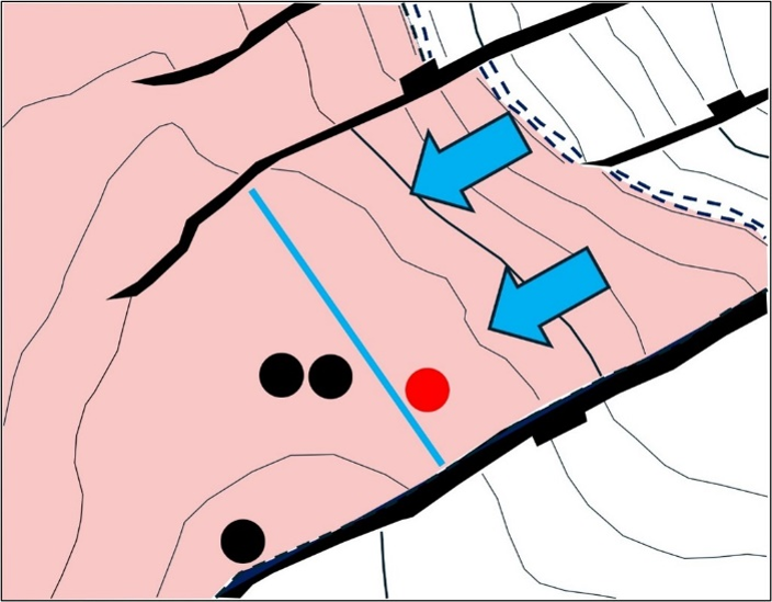
Depth structural map of the gravel pack zone showing the studied well (red dot) is closer to the edge water (blue solid line) compared to the other wells (black dots), and the water drive influx direction is towards the edge water which possibly causing more water drive effect and reducing gas saturation in the well.