Real Results

Performance By The Numbers

Hexa-Combo LWD BHA

Delivered Detailed Reservoir Characterization, Multistage Hydraulic Fracturing Planning, and Optimized Well Placement

Objectives

  • Identify the boundaries of the target zone in order to drill a horizontal section.
  • Obtain data to build an accurate geological model of the drilling zone to perform multistage fracturing operations.

Our Approach

  • Weatherford experts suggested the hexa-combo logging-while-drilling (LWD) bottomhole assembly (BHA), with the distance-to-bed inversion combined with the azimuthal density images, to help locate the target zone boundaries and formation dipping.
  • These services—including deep azimuthal resistivity with boundary mapping inversion, azimuthal sonic, nuclear density, and neutron porosity as well as micro-resistivity imaging—would enable the customer to perform accurate stratigraphic interpretation and ensure proactive well placement, maintaining the well trajectory within planned limits.
  • Micro-resistivity images, recorded while drilling and processed after the tools reached the surface, helped to detect clear geological features, especially fractures and faults, as well as their direction and position.
  • Azimuthal sonic measurements provided information about formation geomechanical properties and stress regime, which gave the basis for the multi-stage fracturing planning.

Value to Customer

  • By using the Weatherford combination of LWD measurements, the operator selected the optimal well path positioning, fractured zones assessment, and fractures type determination.
  • The high-resolution images, delivered while drilling, helped to identify the zones of high production potential and improved reservoir characterization.
  • With the help of the azimuthal density image and bed boundary mapping from resistivity, a precise placement of the well was performed.
  • The addition of the azimuthal sonic measurements provided information for the customer to successfully design a multistage fracturing program.
Details

Location

Kuwait

Well Type

Oil producer

Formation

Carbonate reservoir

Hole Size and Angle

6-1/8 in., 86°

Depth

2,000 ft (609 m)

Products/Services

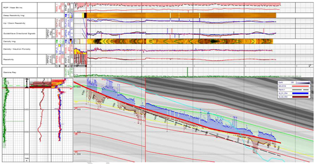
Density image and azimuthal resistivity abrupt variations indicate a down-thrown fault presence with around 8 ft (2.4 m) TVD throw.
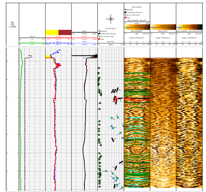
Micro-resistivity image interpretation showing fracture, bed boundary, and faults encountered.

Contact Weatherford

Take the next step in realizing the field of the future. Submit your details and one of our optimization experts will be in touch.