Details
Location
Colombia
Well Type
Exploratory well, deviated
Formation
Natural fracture limestone reservoir
Hole Size and Angle
6-3/4 in., 20°
Temperature
139°F (59.4°C)
Total Depth
6950 ft (2,118 m)
Logging Interval
1,057 to 6,900 ft (322 to 2,103 m) MD
Products/Services
×
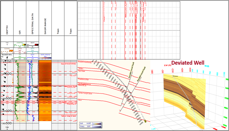
![]()
Structural model representation, showing non-vertical faults, mapped in the dipping azimuth direction of the beds, crossing the Rosa Blanca formation stratigraphic sequence.
×
![]()